Friday, October 17, 2008

Hawaii 2008

I spent two weeks in Hawaii with my parents. The first week was in Maui, which I haven't been to before. The second week was in Kauai, where I've been a number of times. The weather for both weeks was great. We only got sprinkled on a couple of times, with the only hard rain coming while we were safely ensconced in our hotel rooms for the night.

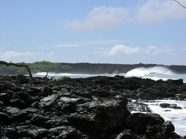
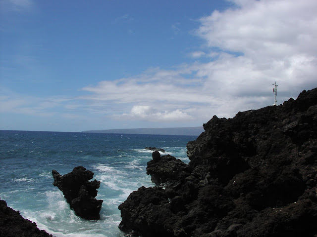
Our first Maui reconnaissance hike was just south of our hotel. The maps showed a 4x4 road leading to La Perouse Bay, but it turned out to be a freshly paved one-lane road. So we drove down and took a short hike partway around the bay. The most recent eruption on Maui was here in 1750, and the coastline was a mix of dark lava and broken white coral. The wind was pushing some pretty good waves into the bay, but the Hawaiians need to have pretty tough feet to hike in with their surfboards while wearing flip flops.

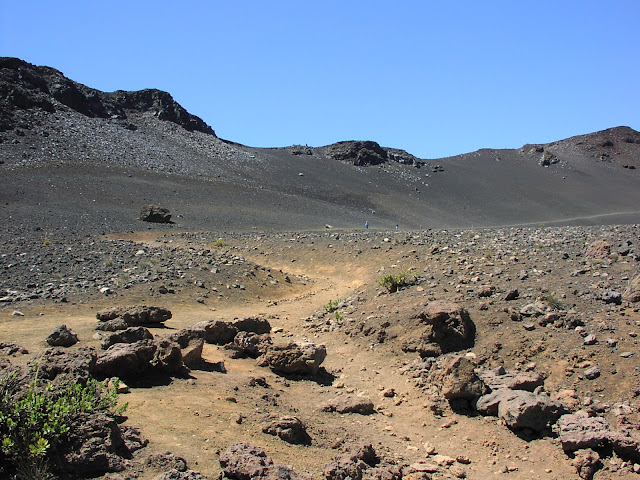
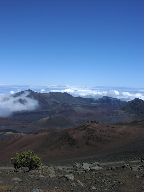
The next day we drove up the main volcano on Maui, Haleakala. We lucked out in having clear skies until we were on the way down. We poked around at various viewpoints on the road, then hiked a little ways down into the crater. At 10,000 feet elevation, the top is usually above the clouds, so it's pretty dry.

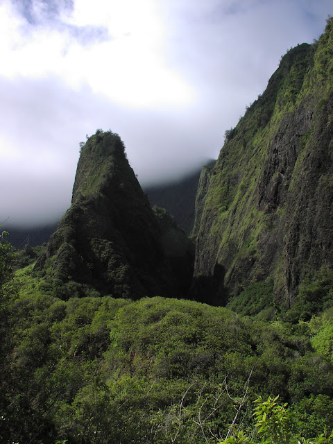
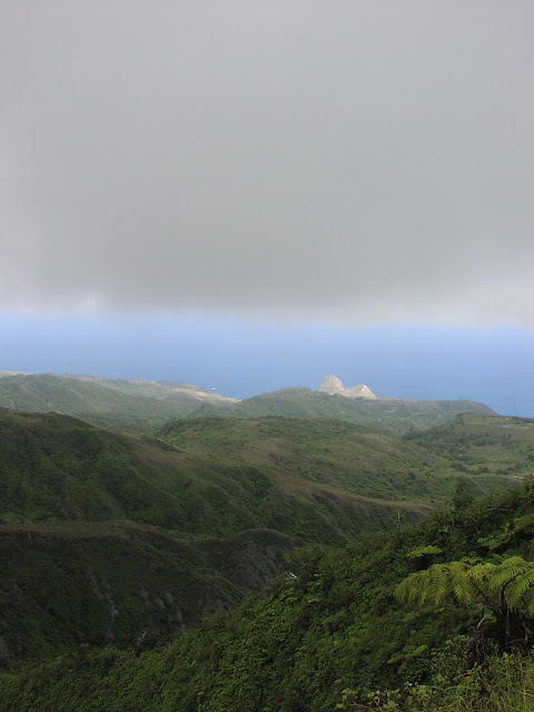
Day 3 took us to Iao Needle on the slopes of Maui's smaller volcano. Unfortunately, most of this terrain is private property, and they've stopped allowing hiking there. The park only has some short paved paths.

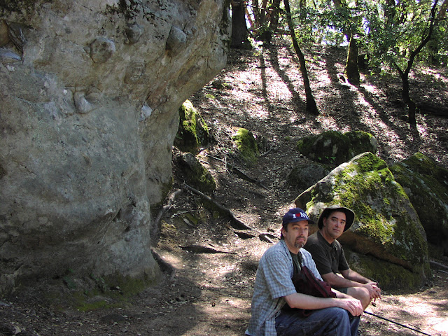
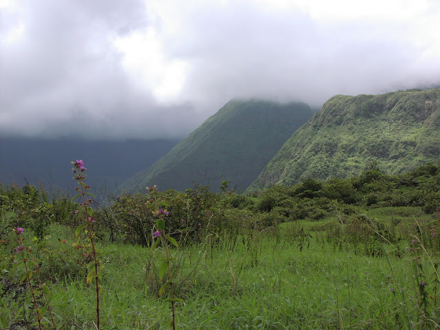
The next day my step-dad Richard and I left my mom at the hotel so that we could go on a real hike along Waihee Ridge. Once again, the clouds held off, closing in on the mountain tops only as we were on the way down.

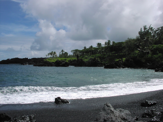
The next day we took the long drive to Hana. It's not actually that far, but much of it is on a narrow, twisty road that narrows to one lane for just about every bridge, which is pretty often on this wet side of the island. We ended up stopping at Waianapanapa beach. It's called a black sand beach, although it's really made of small pebbles. Near the water they're 5-10 mm and very smooth, but they get larger and sharper away from the waves.

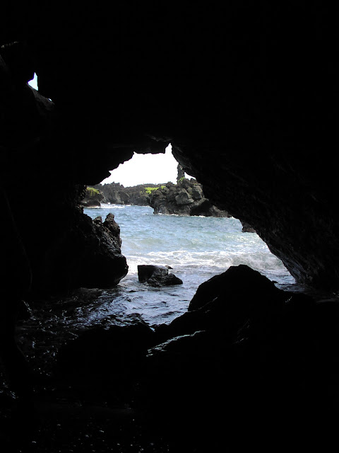
A short tunnel from the beach leads to an opening on the water.

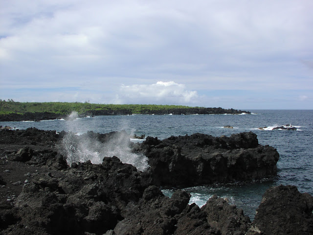
I left my parents to enjoy the serenity of a beachfront cemetery while I scouted up the coast. Once again, the scenery was mostly rugged lava, which sometimes does a good job of directing the waves into the air.

Finally, on the last full day in Maui, Richard and I went for a real hike at La Perouse Bay. After rounding the bay, we started off on the "King's Highway". If this is a highway, I'd hate to see the King's Side Streets.

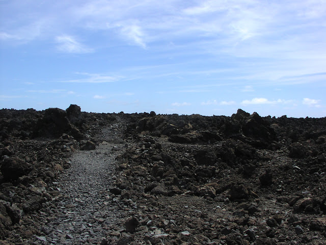
As it turned out, we need to take one of the King's Side Streets to circle back to the bay. This mostly involved following an unimproved route marked by chunks of coral set at each high point to mark a path that avoided the worst hazards.

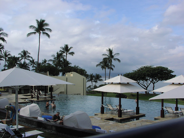
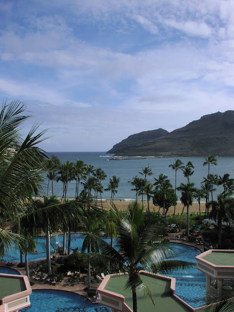
It came time to leave Maui and head to Kauai. I was looking forward to Kauai mostly for the higher quality hiking, but also for its better hotel. The Wailea Marriott on Maui doesn't have its own beach (although beaches are nearby on either side), and its main pool is designed for relaxation.

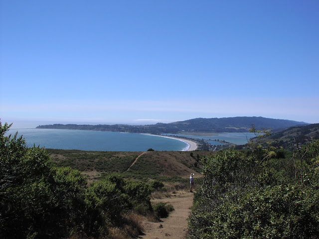
On the other hand, the Lihue Marriott on Kauai has its own beach, and the pool is much bigger with plenty of room to splash around. Plus, since it's a public beach popular with the natives, it gets a younger crowd with surfers always in the water plus the occasional volleyball game on the beach.

We spent the first day doing nothing and the second day snorkeling, so I have no pictures from those days. On day 3 Richard and I went hiking at the Na Pali coast. We were eager to get back to this trail since it'd been closed during our last visit. Just as we were arriving at the beach at the end of the road, the lifeguard was posting a "beach closed" sign due to high surf. Apparently two women had been swept to their deaths the day before, but at least the trail was still open. And beautiful.

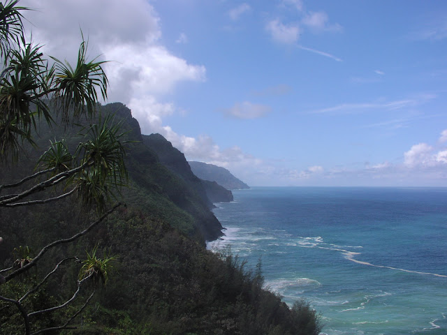
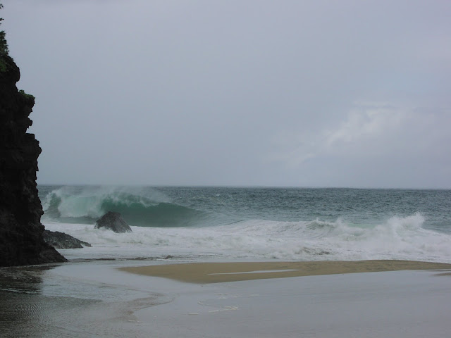
Unfortunately, while we were on the trail we encountered a couple hurrying back towards the beach. The man was trying to get a signal on his cell phone, while the woman was saying, "The best thing we can do is get back to the lifeguard as fast as we can." Uh oh. It turns out that a guy had just been swept off the trail-side beach where we heading. So for the rest of the hike, we got to watch the search and recovery operation. Ugh. Once we got to the beach, we could see the big waves breaking directly on the shore, and how they could easily grab someone who wasn't paying enough attention.

After another rest day, we went kayaking on the Wailua river, then hiked up to the "Secret" Falls. There were a ton of tour groups also there, but they were all well behaved, so all we had to worry about was to not get sucked too deep into the mud. Since I didn't trust my camera to the kayak's dry bag, I have no photos.

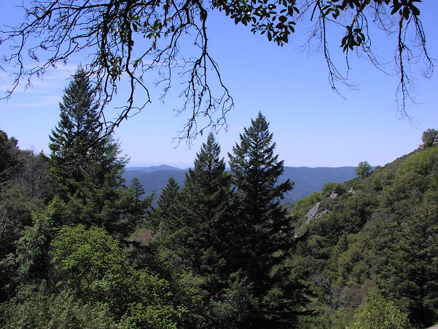
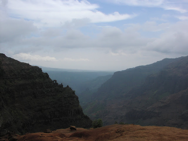
Finally, on the last full day of Kauai we did the best hike of the trip. The plan for Richard and I was to hike a combination of the Cliff and Black Pipe trails to make a 4 mile loop. However, we made a wrong turn which took us back up to the highway at on overlook. There we met another couple who wanted directions to get to the Cliff Trail, so we hitched a ride with them back to where we'd parked. Then, since we'd already scouted the first section of "4x4 trail" and found it passable, we drove in with our rental SUV, saving ourselves a repeat hike along that boring section.

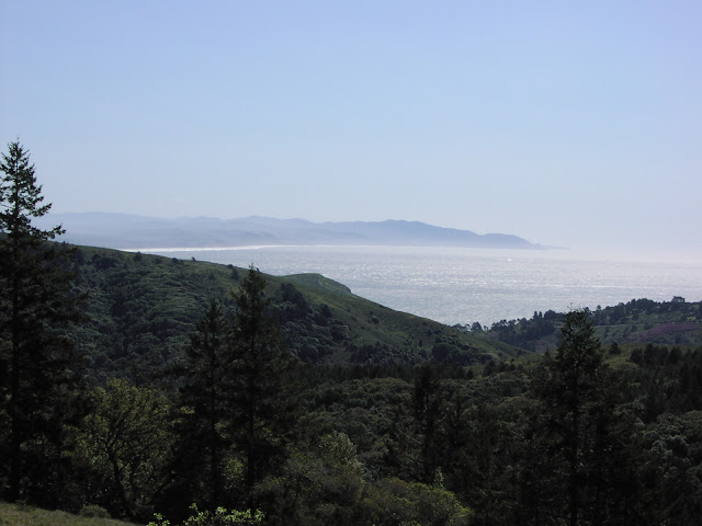
This time we found the proper turn to the cliff overlook, although it turned out to not be the view we were looking for, so we took yet another side trip on the Canyon Trail out to the real overlook.

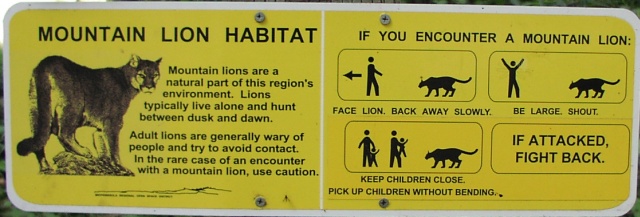
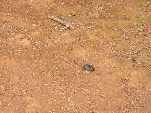
There are no native Hawaiian predators, so the mice here are relatively fearless.

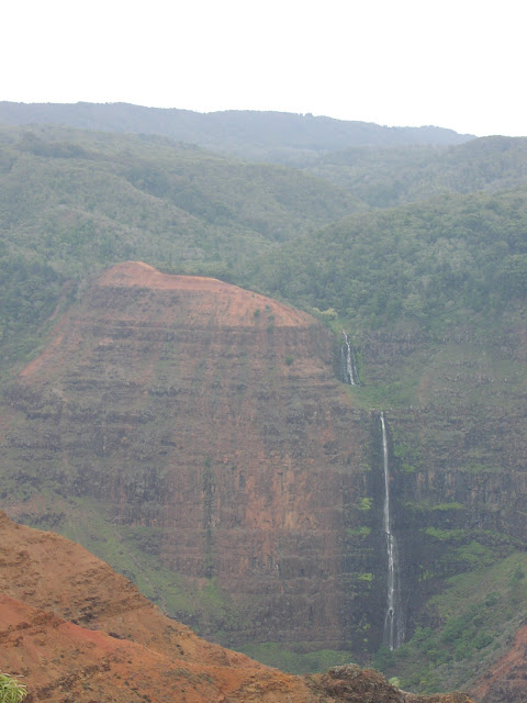
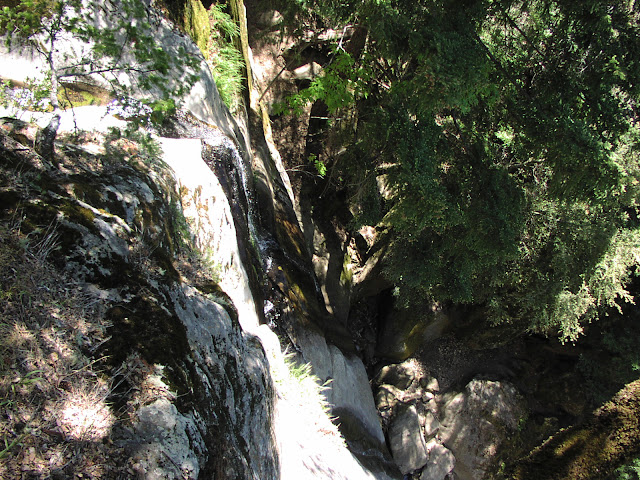
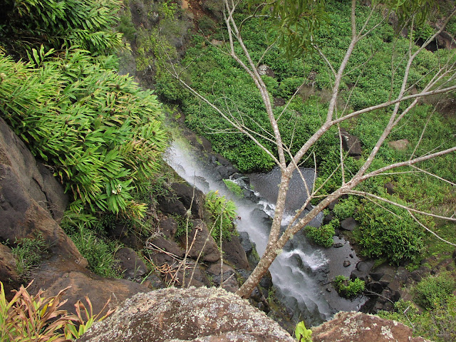
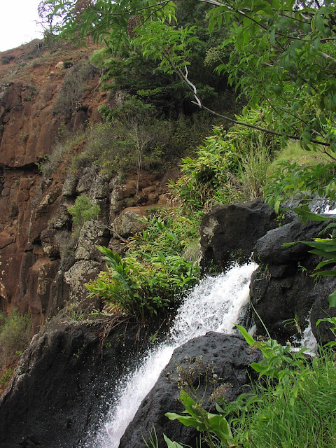
Around the corner from the overlook is the upper part of Waipoo Falls, where some scrambling let me look over both sides.

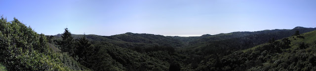
After returning on the Black Pipe Trail, we found another overlook on the highway to see where we'd been.

Saturday, August 16, 2008

Pinnacles Night Hike - 2008

When we camped at Henry Coe last year, I discovered that it's possible to follow a trail at night without a flashlight as long as the moon is full and there are no clouds. I remembered that a couple of weeks ago and wondered what it would be like to hike Pinnacles at night. A few web searches later, and I found that Pinnacles is open for night hikes, the moon would be full on August 16, and the Perseids would be in season as well.

Derek and Maureen and I left Sunnyvale at 4:30pm, stopped at a Mexican fast food joint in Hollister for dinner, and arrived at Pinnacles around 7:15pm. Surprisingly, along with the last few stragglers hiking out, there were other groups besides us getting set to hike in.

The mountains were between us and the sun on the way up, but we were able to catch the last few rays on the hills to the east. Not too much later, the moon came up. It's interesting how fast it appears to rise against the horizon. The Earth rotates 360 degrees in 24 hours, or 1/2 a degree every 2 minutes, which is fast enough to see the motion against the horizon.

There was another group at a trail junction with good northeast visibility, so rather than stop we continued to the top of the hill. This gave us the bonus of seeing the last of the sunset to the west. (Note to self: make sure the camera is stable when taking a shot in the dark.)

The first "star" that became visible was in the wrong direction for Venus and the wrong color for Mars, so I guessed that it was Jupiter. Reviewing the star chart now, I'm pleased to see that I guessed correctly.

Derek was willing to ruin his night sight looking at a star chart, so we were able to find Cassiopea, which was a little further above the horizon than Perseus. We didn't wait long enough and it didn't get dark enough for Perseus to become visible, but we hoped to see some meteors that would radiate in a good direction to become visible. Somehow Maureen managed to spot two, including one in entirely the wrong direction, but Derek and I didn't see any.

We did see a satellite, though. I didn't think to note the time, but based on what flew over that night, I would guess that it was Lacrosse 2.

It was still fun checking out the stars and enjoying the cool weather. Pinnacles is normally very hot in the summer, but even still we took lots of cool clothing for the desert night. As it turned out, it was wonderful hiking and sitting weather, even in shorts and a T-shirt.

Hiking down in the dark was neat. It was easy to follow the trail, although in the shadows I was glad of my hiking boots to protect my toes from tripping and my ankles from twisting.

Sunday, August 3, 2008

Mt. Tam - Summer 2008

Dianna had the baby for the weekend, so Steve was able to join Derek, Maureen, and I for a hike. In honor of the occasion, we went north for another stab at Mount Tamalpais, aka Mt. Tam.

We took a 7-mile route that started in Stinson near the beach, headed up the shoulder of the mountain to a campground, then looped back down along a different path. Much of it was nicely shaded, but it did open out for a bit where we could see San Francisco in the distance.

At the bottom was a short traverse along the foothills back into Stinson. The beach and tourist area was clearly visible.

Monday, May 26, 2008

Rancho San Antonio - May 2008

I haven't had a chance to do the long loop at Rancho San Antonio for a while, so I decided to just go do it, and to not invite anyone who would slow me down or want to take a shortcut. I went early in the morning because parking was a zoo last time I was there, and today is Memorial Day.

The web said that the park is open from dawn to dusk. The sign at the park entrance said 8:00 am to dusk. I got there at 8:20 am, and the upper lots were over half full and the lower lots were completely full except where the occasional early person was already leaving. I got lucky and snagged a spot close to the trailhead.

I took a few photos of the scenery, but it was cloudy and grey, so they didn't come out well. Rather that post those, I'll show you some of the more interesting ones.

They have a new sign describing what do if you encounter a mountain lion. This is the first one I've seen with pictographs. It's mildly amusing.

There were lots of small flowers along the side of the trail.

I got back to the car at 11:40, which means that I did the 10-mile loop in exactly 3 and a third hours, which is 3 mph. Biking to work must have been good for my thighs because boy do my calves hurt.

Sunday, April 27, 2008

Castle Rock - Spring 2008

Jon and Jamshid and I went hiking at Castle Rock. Jamshid suggested it because it's not as steep as some other hikes we've tried. Neither Jamshid nor Jon hikes all that often. Here are Jon (with beard) and Jamshid (without) sitting next to the first big sandstone outcrop we came across. This one was unusual in that it had inclusions of harder rock in it. I don't remember seeing that in the other sandstone outcrops at the park.

The above outcrop was on a spur on the path that lead to a peak with many more sandstone outcrops, of which I didn't take a photo. There was a group there in full climbing gear practicing on one of the taller rocks. I kind of wanted to climb it myself with just my hands and feet, although using an easier path up of course. But I decided not to since they'd already staked their claim to that rock.

We went back down to the main trail and continued along to the falls overlook. Here is a confusingly angled photo to study:

Further along, the train skirted the side of a steep bluff. The views were not entirely spectacular, comprising mostly dense evergreens covering every hill.

From some other vantage points, we thought maybe we could see the ocean. Or was that just low clouds?

After stopping at a bench for a rest, we decided to head back rather than risk wearing ourselves out. We took the direct route back and were back at the car in no time. We probably totalled 4 or 5 miles. Jamshid claimed that this was a good distance.

Sunday, March 16, 2008

Muir Woods

I took a short (4 mile) hike with Steve and Steve's new (6 week) baby, Calder. Calder did OK. At the top, we got a good view of the ocean.

When we got back near the entrance, we stopped at a bench to eat our lunches. Apparently, that's not allowed, and we got busted by a ranger. She was polite, though, and she led us to an area not too far away (just outside the entrance) where we could eat.

I took a panorama from the road looking back over the valley where the entrance is hidden.