On Saturday we climbed from the road at 7500 feet to a saddle at 9700 feet, crossing from the Merced to the Tuolumne watersheds. By that point I was too tired to pull out my camera, so I'll just shuffle a Monday shot forward and pretend that this was our first view of four of the seven Ten Lakes:
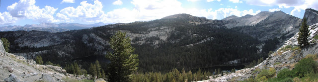
(Yes, there are really four lakes there, although two are somewhat obscured. Plus, they're placed unexpectedly at different altitudes.)
We got confusing information from a hiker we passed, and I failed to reconcile it to the map, so we optimistically continued past the first lake on the trail. Thus, after descending to the western lake at 8900 feet, we added another 1.5 miles and 600 feet to our trek to get to the eastern lake.
Since we had left San Jose at what some considered a reasonable hour, our 8 miles and 2800 feet of climb brought us to our camping spot rather late. We had time to set up tents and cook dinner before it started getting dark, but pumping water, washing up, and other activities meant that we didn't hit the sack until after 9:30.
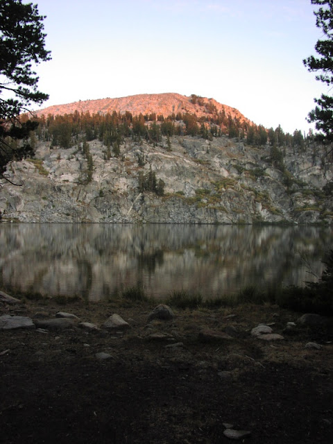
Pulling another shot forward, here's a shot of the unnamed peak above the eastern lake, hit by the sun's last rays:
Sunday we decided to leave our camp in place and just take a day hike. Continuing along the trail wouldn't have brought us to anything interesting within a day. My hiking book suggested following a creek downhill to the north-eastern lake, but that wasn't suitably ambitious for me. Instead we chose our own route to get onto a ridge and from there up to the aforementioned peak above the eastern lake.
I guided us off trail based on my best interpretation of the topo map. Even with the large-scale 200-foot contours, I could see that the ridge was sufficiently delineated that we'd be unlikely to get lost. But I was pleasantly surprised at how well the route worked, with not a single ravine, cliff, or brushy area to complicate our path.
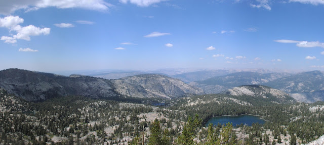
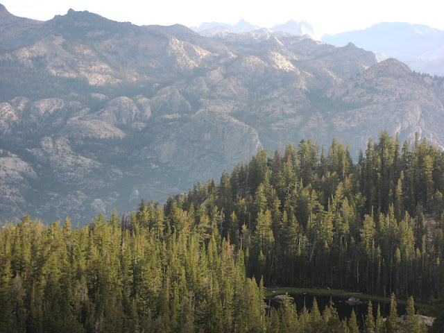
From the 10,200-foot peak, we could look back at five of the seven Ten Lakes, plus the Grand Canyon of the Tuolumne River beyond:
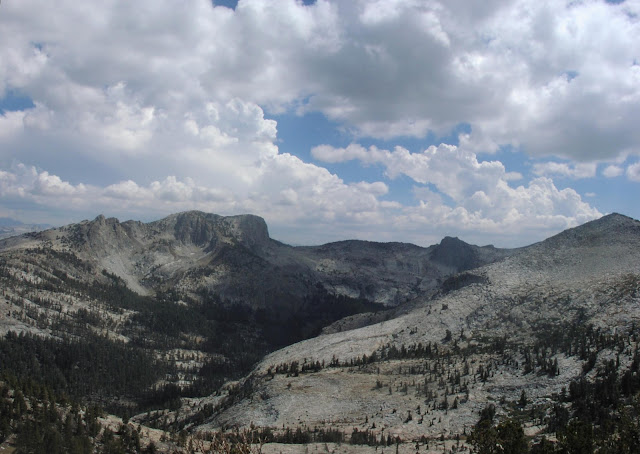
In the opposite direction were the 10,845-foot Tuolumne Peak (tallest on the left) and the 10,850-foot Mt. Hoffmann (the pyramid of loose rock on the right):
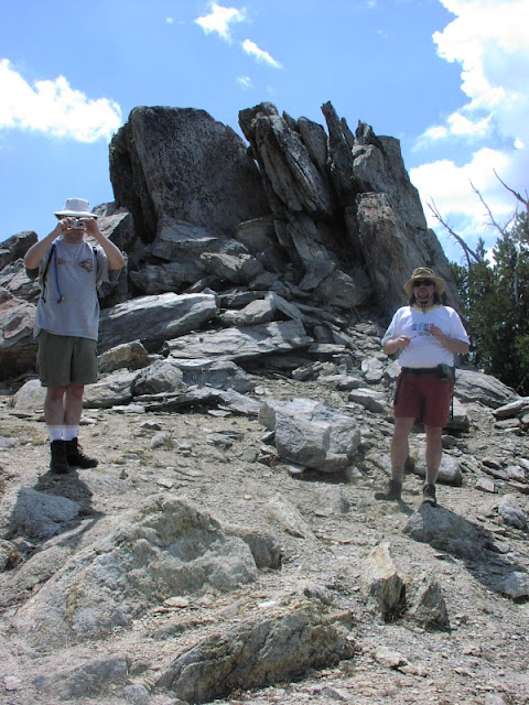
Photographic proof that Derek and Steve also made it:
In another surprising development, we managed to return on almost the exact same route in reverse, recognizing many small landmarks on the way.
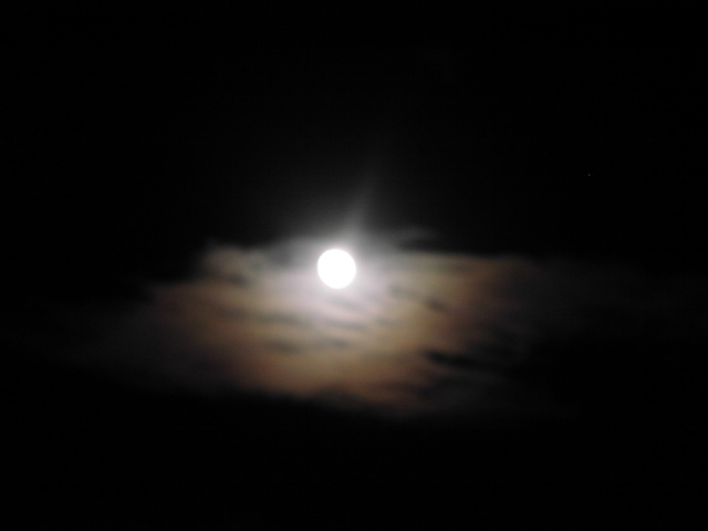
This time we had plenty of time to eat and clean up, then hang out by the lake. We were soon joined by bats, who seemed to be picking bugs off the water surface. Despite how close the bats would come, my camera's shutter delay made it impossible to capture one before it would escape the range of the flash. However, the scattered clouds did make this lovely moonbow:
Monday morning we walked a few hundred yards down to a ridge to overlook the northeastern lake. Although this lake is supposed to be the most isolated, the apparent green scum around the rim would reduce its appeal for camping (i.e pumping water):
After packing up, we headed back. Being predominently downhill, the return trip was noticeably easier. Steve thought we were also better acclimated to the altitude, although I found it hard to separate the various components of tiredness. Mostly my feet hurt.
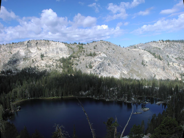
After traversing the ridge containing the eastern lake, we stopped to take in the view of the western lake below. The green swath on the far slope contains the trail back up to the saddle and out.
After climbing down the western lake, we got briefly lost trying to find that trail out, but eventually found it. After that it was down down down to finally get back to the car, mercifully unmolested by bears.
Chris
P.S.