Saturday, December 15, 2007

Kauai 2007

I finally took a camera to Hawaii. The weather generally didn't cooperate for taking good photos, but here's what I got.

From the hotel balcony we could see the cruise ships come into the harbor every other morning, leaving the following afternoon. My mom kept putting cookies on the railing for the birds.

We repeated an ATV tour that'd we taken on an earlier trip. The weather actually cooperated this day. At the end of the tour, our guide threw some pig chow out for the wild pigs.

The Honopu Ridge Trail has been closed since the last hurricane, but the locals have hacked out their own version. As it turned out, however, the best views were on the inland canyon side and from the top of the mountain. The oceanward tip of the ridge was socked in by clouds.

The eastern trail up Nounou Ridge, aka Sleeping Giant, is a typical Kauai hiking trail. I.e. it includes at least 2 of the following 3 features: a water tank in the driving instructions, a hunter check-in station, and a picnic area at the top. I can never tell from the hiking book if I've already been on the trail or not.

The Powerline Trail is a 4x4 road for hunters, complete with ugly power lines. After (or during) a rain, lots of waterfalls are visible on the opposite ridge.

Friday, November 23, 2007

Henry Coe - Fall 2007

Today I decided to try my hand at biking in Henry Coe. I've been thinking about this all summer, but summer is not a good time to do anything too strenuous at Coe. Today, on the other hand was perfect. The projected high for Gilroy was 61, although cooler in the morning, and sunny all day.

I loaded up the car and headed out. Despite being Black Friday, the roads were pretty empty at 9 am. There was a bit of a line of traffic outside the Gilroy outlets, but I avoided that simply by staying in the through lane.

I had brought warmer clothes just in case, but although it was a little chilly in the shade, it wasn't too bad in the sun. And Henry Coe is known for having lots of sun.

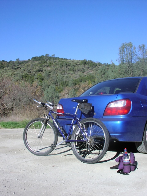
Henry Coe also has a reputation for kicking the asses of cocky bikers, so I made sure to search out the easiest route available in Coe. In particular, I made sure that I'd be going up on the way in so that when I got tired, I could go (mostly) down to get out. The best fit was Coit Road. An easy paved section runs just outside the park from the Hunting Hollow parking area to the Coyote Creek entrance. You can open the map in a separate window if you want to follow along. Hunting Hollow is at the lower left.

The paved part is lined with trees, so it remained rather chilly along here. I kept my speed down to avoid excessive windchill. This was good practice for later; I had all day and I didn't want to tire myself out by attacking the hills too fast.

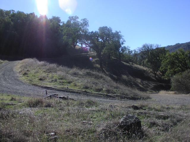
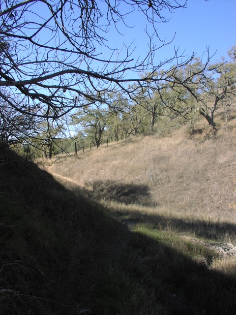
After re-entering Coe, Coit Road turned into a well graded dirt fire road. The road started rolling up and down a bit more, but continued to follow the creek and thus not gain much altitude. A couple of miles in it finally turned uphill. Even there, the hills weren't killer, and I never needed to go to first gear.

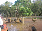
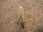
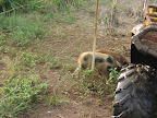
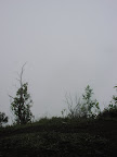
Part way up the hill is Coit Camp, which I guess is a horse camp, judging by the corral. (The Coit Camp Corral might make a good name for a Country & Western band. Do they go for that sort of thing?)

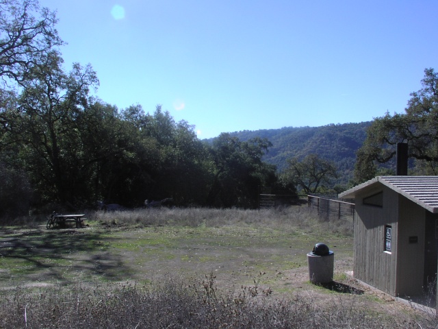
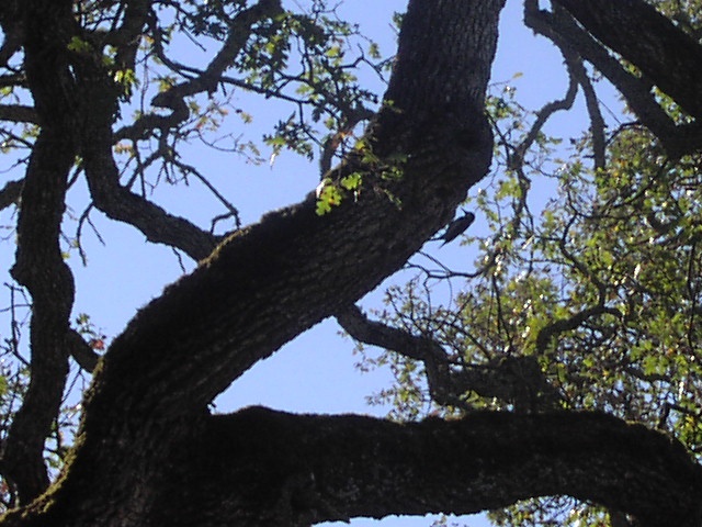
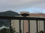
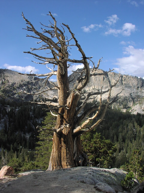
As you can see, the camp also has a luxury outhouse and a picnic area, so it made a nice spot to stop and have an energy bar. Apparently I wasn't bothering the woodpecker that was working on the shady oak above my head.

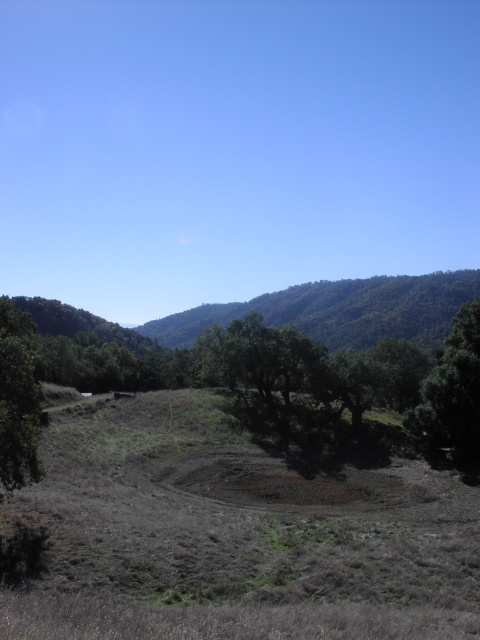
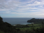
A little further up is an old pond that must have been dammed by a rancher before the state turned it into a park. It's been a dry summer.

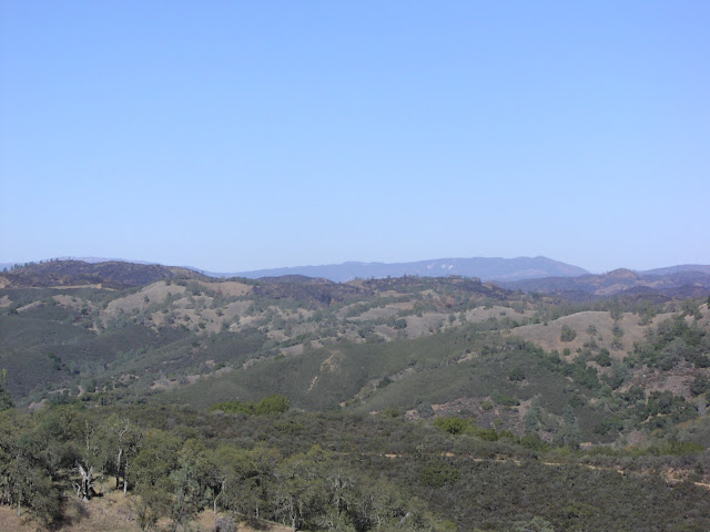
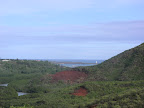
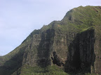
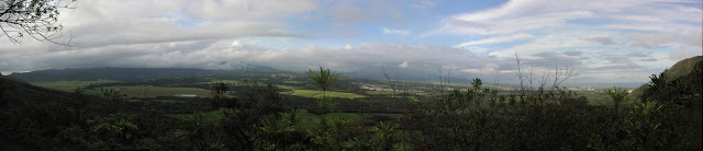
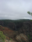
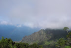
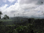
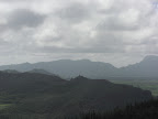
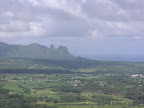
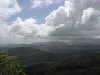
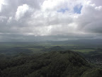
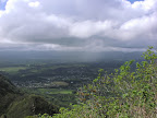
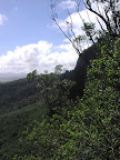
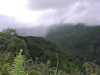
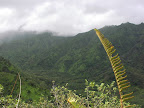
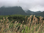
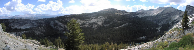
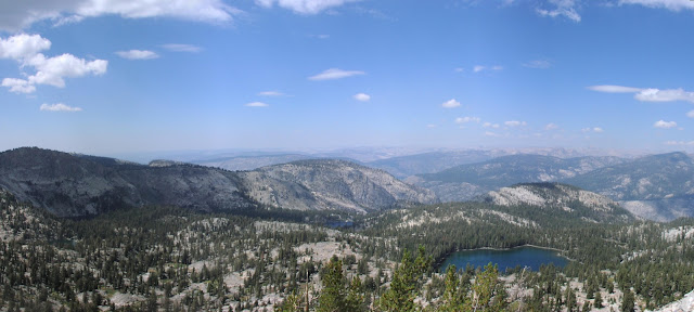
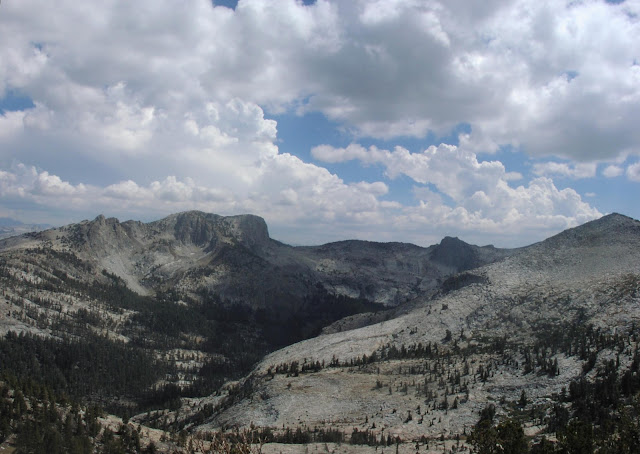
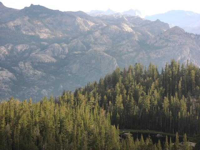
After a last slog uphill, I reached a ridge where Coit Road meets Mahoney Meadows Road and turns right. The ridge is mostly gentle rolling hills, but it does climb to its highest point about 1500 feet above where I parked. I was still feeling reasonably fresh, so I turned onto Wasno Road (another fireroad), then onto the single-track Kelly Lake Trail. This initially rolls along the top of a ridge, eventually giving me the best view I'd get of the area that burned this September (in the far distance).

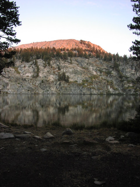
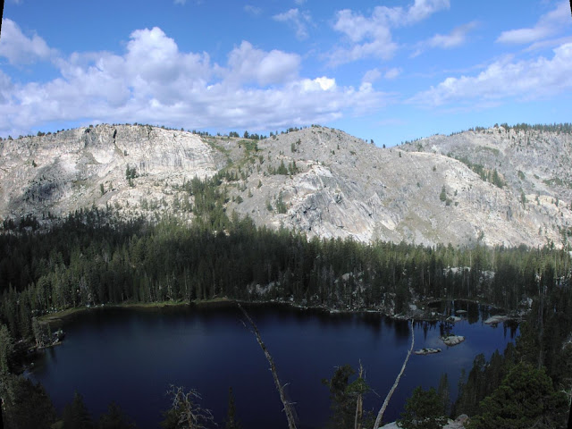
After that it was almost straight downhill. I might not have great uphill skills, but I have pretty good downhill control. I wouldn't recommend this route for most bikers, though. Kelly Lake isn't visible until almost the bottom of the hill.

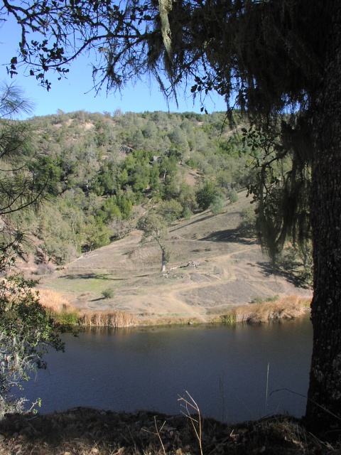
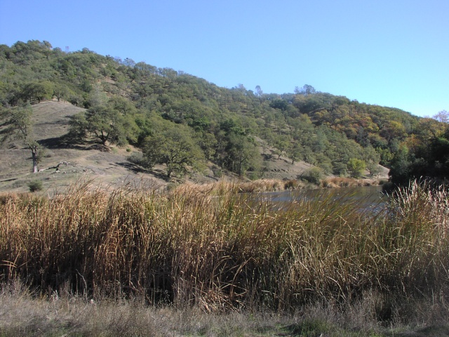
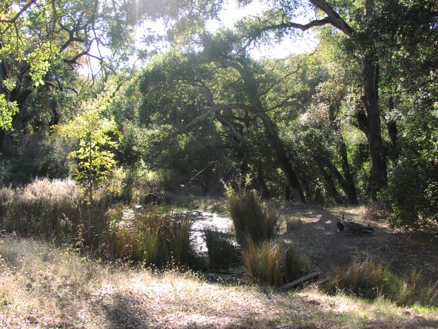
It was around 12:15 when I got to the lake, about 2 hours and 20 minutes after setting out, which meant that it was a good place for lunch. The cattails were a bit drier than they'd been earlier in the year.

I took Coit Road back up to the Wasno Road intersection. This was a far gentler climb that the route I took down, but it was still 600 feet of up, with portions that needed first gear. My thighs were starting to feel the burn by now.

Turning left on Wasno Road, I retraced part of my earlier trip (a nice downhill portion), then turned right onto the single-track toward Domino Pond. The other parts of the trip was worthwhile on their own, but this was definitely the highlight of the ride. Mostly gentle downhill, with a few steeper downhills and short uphills, all with a good flow for coasting. It might be a bit narrow for some, though.

Past the Rock Tower turnoff, the trail turned uphill for a bit, then trended down again after joining Cattle Duster Trail. After turning onto Grapevine Trail, the downhills got steeper, and rock inclusions made some parts decidedly technical. I was proud to get all the way down and across the dry, rocky streambed at the bottom without putting a foot down.

Partway down was this small pond with makeshift bridges. Luckily the board didn't shift as I rode across.

I still had a little energy left, so rather than rejoin Coit Road right away, I turned left onto Anza Trail. This was single-track again, but trending uphill. Without much room to swerve for balance, I had to get off and push on a couple of steep parts, but probably for less than 50 feet total. The uphill trend was still quite tiring, though, so I was quite glad to pass Jackson Trail and start downhill again. This part was clearly more of a hiking trail (wider, and buried under leaves in places), but it still had a nice flow.

Finally a quick drop from Woodchopper Spring brought me back to Coit Road. After one last short uphill, it was downhill just about all the way back to the car.

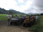
I wasn't sure if the long weekend would bring out more people, or if the shopping season would keep them away. As it turns out, I didn't see anyone at all from the time I left the parking lot until I was almost back to the paved road. However, I did see a few groups starting from just inside the park and then along the paved road. Sometimes I forget that some people like to start out when it's hottest. On the other hand, cool air flows downwards, and I was distinctly chillier once again. I got back to the car at about 2:40.

Gilroy was a nightmare of crazy shoppers, but fortunately I only had to get through a couple of lights to get to the highway. The highway was busy, but not slow.

I am tired.

Monday, August 27, 2007

Ten Lakes - Summer 2007

On Saturday we climbed from the road at 7500 feet to a saddle at 9700 feet, crossing from the Merced to the Tuolumne watersheds. By that point I was too tired to pull out my camera, so I'll just shuffle a Monday shot forward and pretend that this was our first view of four of the seven Ten Lakes:

(Yes, there are really four lakes there, although two are somewhat obscured. Plus, they're placed unexpectedly at different altitudes.)

We got confusing information from a hiker we passed, and I failed to reconcile it to the map, so we optimistically continued past the first lake on the trail. Thus, after descending to the western lake at 8900 feet, we added another 1.5 miles and 600 feet to our trek to get to the eastern lake.

Since we had left San Jose at what some considered a reasonable hour, our 8 miles and 2800 feet of climb brought us to our camping spot rather late. We had time to set up tents and cook dinner before it started getting dark, but pumping water, washing up, and other activities meant that we didn't hit the sack until after 9:30.

Pulling another shot forward, here's a shot of the unnamed peak above the eastern lake, hit by the sun's last rays:

Sunday we decided to leave our camp in place and just take a day hike. Continuing along the trail wouldn't have brought us to anything interesting within a day. My hiking book suggested following a creek downhill to the north-eastern lake, but that wasn't suitably ambitious for me. Instead we chose our own route to get onto a ridge and from there up to the aforementioned peak above the eastern lake.

I guided us off trail based on my best interpretation of the topo map. Even with the large-scale 200-foot contours, I could see that the ridge was sufficiently delineated that we'd be unlikely to get lost. But I was pleasantly surprised at how well the route worked, with not a single ravine, cliff, or brushy area to complicate our path.

From the 10,200-foot peak, we could look back at five of the seven Ten Lakes, plus the Grand Canyon of the Tuolumne River beyond:

In the opposite direction were the 10,845-foot Tuolumne Peak (tallest on the left) and the 10,850-foot Mt. Hoffmann (the pyramid of loose rock on the right):

Photographic proof that Derek and Steve also made it:

In another surprising development, we managed to return on almost the exact same route in reverse, recognizing many small landmarks on the way.

This time we had plenty of time to eat and clean up, then hang out by the lake. We were soon joined by bats, who seemed to be picking bugs off the water surface. Despite how close the bats would come, my camera's shutter delay made it impossible to capture one before it would escape the range of the flash. However, the scattered clouds did make this lovely moonbow:

Monday morning we walked a few hundred yards down to a ridge to overlook the northeastern lake. Although this lake is supposed to be the most isolated, the apparent green scum around the rim would reduce its appeal for camping (i.e pumping water):

After packing up, we headed back. Being predominently downhill, the return trip was noticeably easier. Steve thought we were also better acclimated to the altitude, although I found it hard to separate the various components of tiredness. Mostly my feet hurt.

After traversing the ridge containing the eastern lake, we stopped to take in the view of the western lake below. The green swath on the far slope contains the trail back up to the saddle and out.

After climbing down the western lake, we got briefly lost trying to find that trail out, but eventually found it. After that it was down down down to finally get back to the car, mercifully unmolested by bears.

Chris

P.S.

Sunday, June 24, 2007

Utah Index

Saturday, June 16:

Sunday, June 17: Monday, June 18: Tuesday, June 19: Wednesday, June 20: Thursday, June 21: Friday, June 22: Saturday, June 23: Sunday, June 24:

Return to California

My Utah adventures complete, I spent the rest of Saturday driving across Utah to Cedar City. Sunday I drove the 700 miles from Cedar City to home. Surprisingly, I was able to make the distance in just under two tanks of gas. This is the first time ever that my fuel milage actually matched the EPA highway estimate. Possibly I have never before actually traveled a full tank of gas entirely on interstate highways with no city or mountain driving mixed in.

The drive was pretty uneventful. The only think I distinctly recall is the huge, smelly cattle feedlot near Coalinga. Man, that was gross. I wonder how I'd failed to notice it on my trip out the previous weekend.

Saturday, June 23, 2007

Moab Slickrock

I got up early again on Saturday to head over to the Moab Slickrock mountain biking trail. I thought that the motel's continental breakfast would be available at 6:30am, but I was wrong, and the office didn't open until 7:00am. So I dropped off my key and headed off without breakfast.

The trail is in the Sand Flats Recreation Area, and the entrance station was also not manned quite so early in the morning. Unfortunately I didn't have the appropriate change for self registration. OK, if I had to head back to town for change, at least I could also get breakfast.

OK, so trying again at 7:30am I got myself registered and drove to the head of the trail. My bike had survived the week OK in my trunk (even over the washboards), so I got it put together and set out. After about 100 yards I realized that I'd forgotten my sunscreen. OK, back to the car.

OK, headed out once again. This time I got about 400 yards before stopping for a drink... and realizing that I'd left my water in the car. Grn. Hurrying back to the car, I carried a little to much speed into a gully, trying to keep some momentum up the other side. Wham! My bike just couldn't change angle that fast without taking a beating. The mount for my mini-pump has been cracked for a while, so it doesn't hold quite as securely as it should, and the pump went flying. I was surprised that the only consequence of that heavy hit and horrible scraping noise was the pump falling out.

I retrieved the pump, returned to the car, and strapped on my hippack full of water. On the parking lot it became clear that my front wheel was now scraping the brakes once on each revolution, as if it were now out of true. It was clearly wrong, but not too bad, and I almost decided to go back on the trail that way. But I took a couple more turns around and finally realized that I'd actually unseated the tire in one place. Whew; I could fix that.

OK, one more try. It's a good thing I stopped for water. As this sign made clear, water is highly essential. In fact, the sign had me thinking about maybe not doing the full 12-mile loop. Well, I'd decide how I felt as I went.

I didn't bring my camera along. I feel confident in my biking skills that I figured I probably wouldn't crash, but I didn't want my camera to be under me if I was wrong. So you'll just have to live with this picture from the parking area. Almost all of the trail was along the rock. Although the trail did not go up that rock hill in the center background, that slope is pretty representative of what most of the trail did look like.

Near the beginning of the main trail is a 2-mile practice loop is supposed to cover pretty similar terrain conditions. I went around the loop and found that I was doing OK. I have enough bike control that I could handle even the steepest downhills, although I now made sure to keep my speed under control. Many of the uphills were so steep that I had trouble steering with so little weight on the front tire. A few I had to give up and walk up, but I noticed that I wasn't the only one with that problem, so I didn't feel too bad.

Toward the end of the practice loop, although I was still doing OK, I decided that doing the entire 12-mile loop was going to be too hard to remain fun. I figured I'd continue down the main trail a mile or so to what looked like a decent viewpoint, then perhaps turn around and head back. That seemed like it'd give me enough distance to feel like I had fun, but not so much distance to ruin it.

So I continued on, crawling carefully off each rock fin and and slogging in low gear back up the next one. After what seemed like more than enough distance, I didn't hadn't seen any particular viewpoint, nor did it seem like one would be upcoming, so I went ahead and turned around.

Just past the bottom of the first hill my front tire suddenly started hissing loudly. It didn't take long for it to lose essentially all of its air, but fortunately there was a good shady spot just within range.

I was surprised that I had gotten a flat since I hadn't hit anything, and there hadn't been any obvious sharp things on the polished rock. Upon inspection, I realized that it wasn't a puncture at all. The problem was that the valve stem had cracked at the base. My best guess is that the tube hadn't been seated quite straight, perhaps after the hard hit earlier in the morning. Or perhaps the tube was simply old enough that it couldn't stand up to the sustained forces from the hard downhill braking.

The next guy along kindly offered assistance, but I waved him off since I had all the things needed to replace the tube. Or so I thought. Just after he rode off I realized that I'd forgotten one more thing in the car: spare tubes. [Insert swearing here.]

It's bad for the tire to roll on it with an empty tube, so I hitched the front of the bike under my arm and started hiking back to the car. That was pretty tiring, but I soon realized that I could flip the bike over and push it by the handlebars while rolling it on its rear tire. This was reasonably comfortable except that by this time rivers of gross dirty sweat were dripping into my eyes, and I didn't have a hand free to wipe my face.

Looking on the bright side, that final incident ensured that I had no regrets about leaving Utah and heading home. I had no pangs of, "Gee, I'd love to stay out here just one more day."

Moab Slickrock
Time: 7:30am - 9:45am
Biking distance: 2.0 miles
Biking ascent: ~400 feet
Hiking distance: 1.2 miles
Biking ascent: ~200 feet
Water: 1.5 liters